Pricing Change
New pricing for orders of material from this site will come into place shortly. Charges for supply of digital images, digitisation on demand, prints and licensing will be altered.
Westerwood, Antonine Wall
Altar(S) (Roman), Fortlet (Roman)(Possible), Frontier Defence (Roman), Roman Fort (Roman)
Site Name Westerwood, Antonine Wall
Classification Altar(S) (Roman), Fortlet (Roman)(Possible), Frontier Defence (Roman), Roman Fort (Roman)
Canmore ID 45870
Site Number NS77NE 8
NGR NS 76070 77360
NGR Description Centre
Datum OSGB36 - NGR
Permalink http://canmore.org.uk/site/45870
- Council North Lanarkshire
- Parish Cumbernauld
- Former Region Strathclyde
- Former District Cumbernauld And Kilsyth
- Former County Dunbartonshire
NS77NE 8 76070 77353
(NS 76070 77353) Roman Fort (R) (site of)
OS 1:10000 map (1976)
The Roman fort at Westerwood abutting the Antonine Wall measured internally 280ft E-W by 300ft transversely, covering an area of nearly 2 acres. Excavations were carried out in 1932 by Sir George Macdonald.
The rampart surrounding the other three sides was of turf on a stone foundation about 16ft broad. Nothing could be found about the NE corner as the buildings of Westerwood farm steading overlie the defences. There were two ditches outside the rampart, with a third along the stretch from the W gate northwards. On the S, and the N, the ditches are not interrupted by a passage, although there is a gate in each of these ramparts. The E and W gates lie further N that the centre of the fort. Excavations proved that the wall was completed before the fort.
Of the internal structures, little was found. The majority of the wooden barrack-blocks were to the S of the via principalis. The fragment of a wall close to the W rampart showed that a stone building had run N-S there; and another fragment found against the Antonine Rampart on the N indicated the remains of a bath-house - a drain ran from it under the W rampart.
A kiln was found built into the Antonine Rampart a little to the W of the N gate.
A portion of a loop of the Military Way was uncovered outside the ditches at the SE corner of the fort.
It is possible that the fort overlay the site of an Agricolan fort, although, except for the peculiarity of the ditches, no conclusive evidence has been encountered.
Finds, datable to the 2nd century, include a few pottery sherds and some ballista balls. A coin of Hadrian was found nearby, on the Military Way, a little E of the fort (see NS77NE 11). Gordon and Maitland, in the 18th century, mention inscribed stones having been dug up here and built into the houses, but other than a few tooled stones being observed in the walls around the stackyard, there is no record of these inscribed stones.
Visible on aerial photographs (106G/Scot/UK10: 7094; 58/3544/F44: 0342). G Macdonald 1933; 1934
The two ditches and rampart have been ploughed down to appear only as a large, broad hollow 20m wide and 1.2m deep. There is also a large outer swelling in the ground about 16m broad. The whole area of the fort has been ploughed over and built upon in the NE corner.
Visited by OS (JLD) 16 January 1957
An altar to Silvanus, ploughed up within or just W of the fort in 1963 is now in Falkirk Museum.
R P Wright 1969
NS 761 773. In 1974 and 1975 excavations in advance of development to the S and SE of the fort, failed to locate evidence of a vicus, and only medieval and later features were revealed. In 1978, a pipe trench in the NW quadrant of the fort revealed flat slabbing and stonework which together with finds of tile and brick suggest a cutting through the bath-house.
L J F Keppie 1974; 1975; 1978; 1979
The area of the fort is still regularly ploughed and the broad ditch is becoming less pronounced; it now averages 0.6m deep. Westerwood farm is now a youth centre.
Revised at 1:2500.
Visited by OS (MJF) 20 May 1980
Photographed by the RCAHMS in 1980 (colour transparencies).
In November 1987, the laying of an electricity cable badly disturbed the square stonework forming one face of a NS partition wall of the internal bathhouse, W of the fort's N gate. Heavy burning visible on some of the stones, and in section, suggested that the stonework had flanked a hypocaust basement. Some facing stones were removed for examination, and the rest backfilled. The stone base of the Antonine Wall was observed, on the expected alignment, but only its S half had survived. Part of one hypocaust brick was recovered.
L J F Keppie 1987.
NS 7605 7735 Magnetic survey in March 2006 of 3ha within the fort and to its S and W revealed some structures within the fort, the Military Way to the W and various anomalies that probably represent post-Roman structures. Construction of the adjacent golf course appears to have adversely affected potential structures existing to the S and W of the fort.
Sponsor: EU Culture 2000.
Richard Jones, 2006.
Antiquarian Observation (1726)
Gordon and Maitland, in the 18th century, mention inscribed stones having been dug up here and built into the houses, but other than a few tooled stones being observed in the walls around the stackyard, there is no record of these inscribed stones.
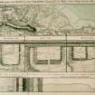
Antiquarian Mapping (1793)
Excavation (1932)
NS77NE 8 76070 77353
(NS 76070 77353) Roman Fort (R) (site of)
OS 1:10000 map (1976)
The Roman fort at Westerwood abutting the Antonine Wall measured internally 280ft E-W by 300ft transversely, covering an area of nearly 2 acres. Excavations were carried out in 1932 by Sir George Macdonald.
The rampart surrounding the other three sides was of turf on a stone foundation about 16ft broad. Nothing could be found about the NE corner as the buildings of Westerwood farm steading overlie the defences. There were two ditches outside the rampart, with a third along the stretch from the W gate northwards. On the S, and the N, the ditches are not interrupted by a passage, although there is a gate in each of these ramparts. The E and W gates lie further N that the centre of the fort. Excavations proved that the wall was completed before the fort.
Of the internal structures, little was found. The majority of the wooden barrack-blocks were to the S of the via principalis. The fragment of a wall close to the W rampart showed that a stone building had run N-S there; and another fragment found against the Antonine Rampart on the N indicated the remains of a bath-house - a drain ran from it under the W rampart.
A kiln was found built into the Antonine Rampart a little to the W of the N gate.
A portion of a loop of the Military Way was uncovered outside the ditches at the SE corner of the fort.
It is possible that the fort overlay the site of an Agricolan fort, although, except for the peculiarity of the ditches, no conclusive evidence has been encountered.
Finds, datable to the 2nd century, include a few pottery sherds and some ballista balls. A coin of Hadrian was found nearby, on the Military Way, a little E of the fort (see NS77NE 11). Gordon and Maitland, in the 18th century, mention inscribed stones having been dug up here and built into the houses, but other than a few tooled stones being observed in the walls around the stackyard, there is no record of these inscribed stones.
Visible on aerial photographs (106G/Scot/UK10: 7094; 58/3544/F44: 0342). G Macdonald 1933; 1934
Aerial Photography (29 July 1945)
Aerial Photography (1 August 1946)
Aerial Photography (7 July 1948)
Aerial Photography (6 July 1949)
Aerial Photography (11 July 1951)
Field Visit (16 January 1957)
The two ditches and rampart have been ploughed down to appear only as a large, broad hollow 20m wide and 1.2m deep. There is also a large outer swelling in the ground about 16m broad. The whole area of the fort has been ploughed over and built upon in the NE corner.
Visited by OS (JLD) 16 January 1957
Aerial Photography (16 July 1958)
Aerial Photography (14 July 1959)
Aerial Photography (2 August 1966)
Salvage Record (1978)
In 1978, a pipe trench in the NW quadrant of the fort revealed flat slabbing and stonework which together with finds of tile and brick suggest a cutting through the bath-house.
L J F Keppie 1978; 1979
Field Visit (20 May 1980)
The area of the fort is still regularly ploughed and the broad ditch is becoming less pronounced; it now averages 0.6m deep. Westerwood farm is now a youth centre.
Revised at 1:2500.
Visited by OS (MJF) 20 May 1980
Note (1982)
Westerwood, Fort NS 760 773 NS77NE 8
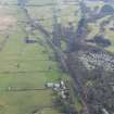
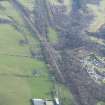
Situated on a slight N-facing slope high above the upper reaches of the River Kelvin, on ground partly covered by Westerwood farmhouse (now an outdoor recreation centre), this fort is one of the stations on the Antonine Wall. When excavated in 1932, it was found to have measured about 88m by 84m (0.74ha) internally. The fort abuts the S face of the Antonine Rampart and has been additionally defended, for most of the circuit, by two ditches; the hollow that marks the course of the latter is at present the most conspicuous feature of the site. More recent excavation in the area to the S of the fort failed to confirm the existence on this side of either an annexe or the loop of the Military Way tentatively identified by Macdonald.
RCAHMS 1982
(Macdonald 1933, 277-96; 1934, 256; Keppie 1978, 12-18
Salvage Record (November 1987)
In November 1987, the laying of an electricity cable badly disturbed the square stonework forming one face of a NS partition wall of the internal bathhouse, W of the fort's N gate. Heavy burning visible on some of the stones, and in section, suggested that the stonework had flanked a hypocaust basement. Some facing stones were removed for examination, and the rest backfilled. The stone base of the Antonine Wall was observed, on the expected alignment, but only its S half had survived. Part of one hypocaust brick was recovered.
L J F Keppie 1987.
Magnetometry (20 March 2006 - 24 March 2006)
area A
NS 7605 7735 Magnetic survey in March 2006 of 3ha within the fort and to its S and W revealed some structures within the fort, the Military Way to the W and various anomalies that probably represent post-Roman structures. Construction of the adjacent golf course appears to have adversely affected potential structures existing to the S and W of the fort.
Sponsor: EU Culture 2000.
R Jones 2006
Magnetometry (20 March 2006 - 24 March 2006)
area B
NS 7605 7735 Magnetic survey in March 2006 of 3ha within the fort and to its S and W revealed some structures within the fort, the Military Way to the W and various anomalies that probably represent post-Roman structures. Construction of the adjacent golf course appears to have adversely affected potential structures existing to the S and W of the fort.
Sponsor: EU Culture 2000.
Richard Jones, 2006.
Magnetometry (20 March 2006 - 24 March 2006)
area C
NS 7605 7735 Magnetic survey in March 2006 of 3ha within the fort and to its S and W revealed some structures within the fort, the Military Way to the W and various anomalies that probably represent post-Roman structures. Construction of the adjacent golf course appears to have adversely affected potential structures existing to the S and W of the fort.
Sponsor: EU Culture 2000.
Richard Jones, 2006.
Magnetometry (20 March 2006 - 24 March 2006)
area D
NS 7605 7735 Magnetic survey in March 2006 of 3ha within the fort and to its S and W revealed some structures within the fort, the Military Way to the W and various anomalies that probably represent post-Roman structures. Construction of the adjacent golf course appears to have adversely affected potential structures existing to the S and W of the fort.
Sponsor: EU Culture 2000.
Richard Jones, 2006.
Watching Brief (8 December 2008 - 9 December 2008)
NS 7606 7741 to NS 7619 7739 A watching brief was maintained during the excavation of a 140m section of a
service trench across the site of the Antonine Wall and associated fortlet at Westerwood, on 8–9 December 2008. No significant archaeological features or artefacts were identified.
Archive: RCAHMS (intended)
Funder: Q Hotels
Martin Cook – AOC Archaeology Group
Publication Account (2008)
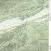
A 1:25000 scale map of the Antonine Wall was published by RCAHMS in 2008. The map shows the course of the Antonine Wall on a modern map base, including areas where the Wall is in public ownership or care and can be visited. The data had been collated as part of the project to prepare maps for the World Heritage Site nomination bid.
Watching Brief (10 February 2011)
NS 7534 7732 A watching brief was maintained on 10 February 2011 during the excavation of a single small trench required for the foundations of a new visitor information board. There were no finds or features of archaeological significance.
Archive: RCAHMS (intended)
Funder: Historic Scotland
Kirkdale Archaeology, 2011 kirkdale1-172051
Note (18 January 2023)
The location, classification and period of this site have been reviewed.


